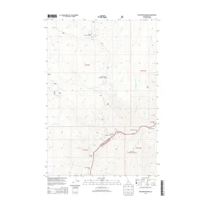
2013 Map of Whitewater Ranch
USGS Topo · Published 2013About this map
Whitewater Ranch and its neighboring Whitewater Campground sit at the intersection of significant wilderness boundaries in central Idaho. This 2013 survey documents a remote landscape defined by the Salmon River canyon, where the Nez Perce National Forest and Payette National Forest meet. The river corridor is marked by series of significant geographical features including Big Mallard Rapids, Little Mallard Rapids, and Elkhorn Rapids. These white-water features are interspersed with alluvial sandbars such as Big Mallard Creek Bar and Elkhorn Bar. Aviation access for this isolated terrain is provided by the Mallard Creek Ranch Airport in the northern portion of the map, while drainage is dominated by the Big Mallard Cr and Little Mallard Cr systems. The map also captures notable vertical drops like Mallard Creek Falls and high vantage points including Vitta Point and Bat Point.
Find a feature on this map
47 named features on this map. Tap any name to fly to it.
Don’t see what you’re looking for? This feature index may not catch every label — zoom into the map to look around manually.
Map Details
Editions of this 2013 Whitewater Ranch Map
This is the sole edition of this map. No revisions or reprints were ever made.
Other maps of this area

1956 · Elk City
USGS Topo · 1:250,000

1960 · Elk City
USGS Topo · 1:250,000

1974 · Meadow Of Doubt
USGS Topo · 1:24,000

1977 · Boston Mtn
USGS Topo · 1:24,000

1978 · Moose Butte
USGS Topo · 1:24,000

1978 · Hida Point
USGS Topo · 1:24,000

1978 · Trapper Creek
USGS Topo · 1:24,000

1979 · Dixie
USGS Topo · 1:24,000

1979 · Fivemile Bar
USGS Topo · 1:24,000
1979 · Whitewater Ranch
USGS Topo · 1:24,000