
1979 Map of Dixie
USGS Topo · Published 1985About this map
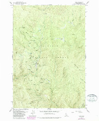
Nez Perce National Forest forms the backdrop for this intensive look at a high-elevation mining district in the late 1970s. The landscape is heavily marked by gold-era industry, with a high concentration of lode and placer operations such as the Black Diamond Mine, Swastika Mine, and Dixie Queen Mine. The layout of the region revolves around the drainage of Crooked Creek and the high point of Dixie Summit, where a network of primitive jeep trails and pack trails provided the only access to remote claims. Traces of early 20th-century habitation are visible at the Dixie House ruins and the Midasville site, while the Cem and Dixie Landing Strip serve as markers of the enduring small community. The mapping of Hundred Dollar Gulch and Nugget Gulch suggests the specific draws that once attracted prospectors to this corner of Idaho County.
Find a feature on this map
60 named features on this map. Tap any name to fly to it.
Don’t see what you’re looking for? This feature index may not catch every label — zoom into the map to look around manually.
Map Details
Editions of this 1979 Dixie Map
2 editions found
Other maps of this area

1931 · Buffalo Hump
USGS Topo · 1:125,000

1934 · Buffalo Hump
USGS Topo · 1:125,000

1956 · Warren
USGS Topo · 1:62,500

1956 · Elk City
USGS Topo · 1:250,000

1960 · Elk City
USGS Topo · 1:250,000

1977 · Silver Spur Ridge
USGS Topo · 1:24,000

1978 · Moose Butte
USGS Topo · 1:24,000

1978 · Trapper Creek
USGS Topo · 1:24,000
1979 · Orogrande
USGS Topo · 1:24,000

1979 · Fivemile Bar
USGS Topo · 1:24,000