
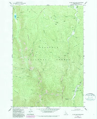
1977 Map of Silver Spur Ridge
USGS Topo · Published 1977About this map
Columbia Ridge and Mc Guire Ridge dominate this section of the Nez Perce National Forest, where a network of trails reveals a history of backcountry habitation and resource extraction. The map documents numerous mining claims tucked into the drainages of Big Meadows Creek and Lake Creek, including the Hematite Mine, Gold Master Mine, and the Union Group Mines. These sites, along with the Dixie Royal Mine near the southern boundary, highlight the area's legacy of prospecting.
Find a feature on this map
41 named features on this map. Tap any name to fly to it.
Don’t see what you’re looking for? This feature index may not catch every label — zoom into the map to look around manually.
Map Details
Editions of this 1977 Silver Spur Ridge Map
2 editions found
Other maps of this area

1931 · Buffalo Hump
USGS Topo · 1:125,000

1934 · Buffalo Hump
USGS Topo · 1:125,000

1956 · Warren
USGS Topo · 1:62,500

1956 · Elk City
USGS Topo · 1:250,000

1960 · Elk City
USGS Topo · 1:250,000

1978 · Moose Butte
USGS Topo · 1:24,000

1979 · Buffalo Hump
USGS Topo · 1:24,000
1979 · Orogrande
USGS Topo · 1:24,000

1979 · Dixie
USGS Topo · 1:24,000

1979 · Fivemile Bar
USGS Topo · 1:24,000