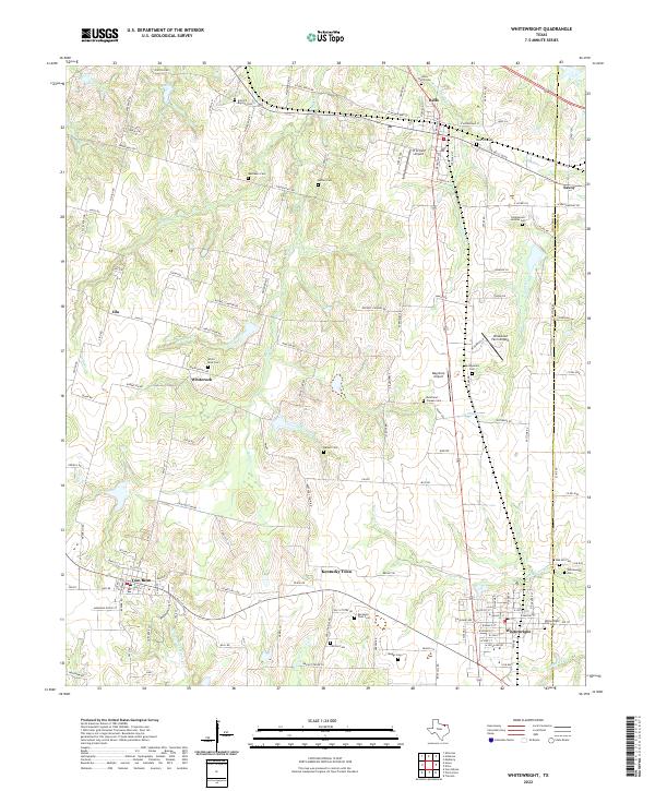
2022 Map of Whitewright
USGS Topo · Published 2022About this map
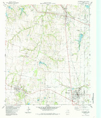
Whitewright and Tom Bean anchor this portion of the Texas blackland prairies, where the landscape is defined by the headwaters of numerous creeks. The terrain is notably dissected by Bois d'Arc Cr, Pilot Grove Cr, and Mill Cr, creating a network of drainage patterns that have historically shaped local agriculture and settlement. Small aviation hubs like Pritchard Airport and Windwood Farm Airport are interspersed among the larger towns of Bells and Savoy, reflecting a modern layer over the traditional rural structure.
Find a feature on this map
139 named features on this map. Tap any name to fly to it.
Don’t see what you’re looking for? This feature index may not catch every label — zoom into the map to look around manually.
Map Details
Editions of this 2022 Whitewright Map
This is the sole edition of this map. No revisions or reprints were ever made.