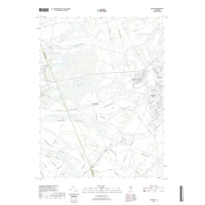
2019 Map of Whiting
USGS Topo · Published 2019About this map
Whiting serves as the primary residential hub in this interior section of the Pine Barrens, where planned communities like Roosevelt City and Cedar Glen Lakes meet the edge of extensive military and state lands. The landscape is defined by its complex hydrology, with the headwaters of the N Br Mount Misery Brook and Pole Bridge Br weaving through low-lying wetlands. Historical industry and resource extraction are suggested by features like Clay Mine Rd and Glassworks Rd, pointing to the area's legacy of silica and clay harvesting. The northern boundary is marked by the presence of the Fort Dix Military Reservation, while the transition into the Lebanon State Forest region illustrates the long-standing preservation of this distinct New Jersey ecosystem. Small named localities such as Buckingham and Bullock remain as markers of earlier rural settlement patterns along the interior road network.
Find a feature on this map
102 named features on this map. Tap any name to fly to it.
Don’t see what you’re looking for? This feature index may not catch every label — zoom into the map to look around manually.
Map Details
Editions of this 2019 Whiting Map
This is the sole edition of this map. No revisions or reprints were ever made.
Other maps of this area

1884 · Whitings
USGS Topo · 1:62,500

1888 · Bordentown
USGS Topo · 1:62,500

1888 · Pemberton
USGS Topo · 1:62,500

1888 · Cassville
USGS Topo · 1:62,500

1888 · Whitings
USGS Topo · 1:62,500

1893 · Bordentown
USGS Topo · 1:62,500

1894 · Cassville
USGS Topo · 1:62,500

1894 · Pemberton
USGS Topo · 1:62,500

1898 · Pemberton
USGS Topo · 1:62,500

1900 · Cassville
USGS Topo · 1:62,500
Featured Places
- Jackson Township, NJ
- Manchester Township, NJ
- Lacey Township, NJ
- Plumsted Township, NJ
- Cedar Glen Lakes, Manchester Township