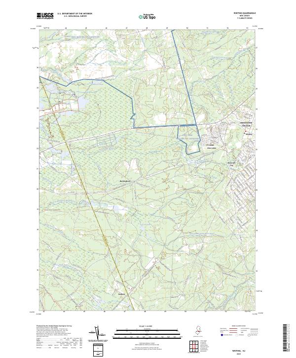
2023 Map of Whiting
USGS Topo · Published 2023About this map
The Fort Dix Military Reservation anchors the northern reaches of this New Jersey landscape, where the Pine Barrens' characteristic drainage patterns are visible through networks like Old Hurricane Brook and Gaunts Brook. Significant residential clusters appear at Crestwood Village, Cedar Glen Lakes, and Roosevelt City, contrasted by the more dispersed settlements of Buckingham and Bullock. The map illustrates a region shaped by both its natural hydrology and historical industry, with the Whitesbog Village Driving Tour Trl and Glassworks Path Trl referencing the area's agricultural and manufacturing past. Water features such as Hanover Pond and the North Branch Mount Misery Brook define the low-lying terrain, while a complex grid of local roads and named paths like Pasadena Woodmansie Rd connects these disparate Pinelands communities.
Find a feature on this map
103 named features on this map. Tap any name to fly to it.
Don’t see what you’re looking for? This feature index may not catch every label — zoom into the map to look around manually.
Map Details
Editions of this 2023 Whiting Map
This is the sole edition of this map. No revisions or reprints were ever made.
Other maps of this area

1884 · Whitings
USGS Topo · 1:62,500

1888 · Bordentown
USGS Topo · 1:62,500

1888 · Pemberton
USGS Topo · 1:62,500

1888 · Cassville
USGS Topo · 1:62,500

1888 · Whitings
USGS Topo · 1:62,500

1893 · Bordentown
USGS Topo · 1:62,500

1894 · Cassville
USGS Topo · 1:62,500

1894 · Pemberton
USGS Topo · 1:62,500

1898 · Pemberton
USGS Topo · 1:62,500

1900 · Cassville
USGS Topo · 1:62,500
Featured Places
- Jackson Township, NJ
- Manchester Township, NJ
- Lacey Township, NJ
- Plumsted Township, NJ
- Cedar Glen Lakes, Manchester Township