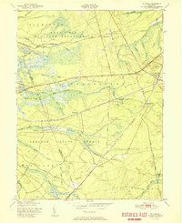
1951 Map of Whiting
USGS Topo · Published 1951About this map
Fort Dix Military Reservation and Lebanon State Forest dominate this mid-century landscape in Ocean County, where the Pine Barrens' industrial and transit legacy is clearly etched into the terrain. The village of Whiting serves as a critical junction for the Pennsylvania Railroad and the Jersey Central Railroad, reflecting the area's importance as a transportation hub for timber and agricultural products. Throughout the low-lying wetlands, numerous Cranberry Bogs follow the courses of Bridge Branch and North Branch, illustrating the specialized hydrology of New Jersey's coastal plain. Small settlements like Roosevelt City, Pasadena, and Bullock are connected by a network of sandy tracks and early paved routes such as the Rockefeller Memorial Highway, showing a region defined by its conservation areas and military footprint.
Find a feature on this map
42 named features on this map. Tap any name to fly to it.
Don’t see what you’re looking for? This feature index may not catch every label — zoom into the map to look around manually.
Map Details
Editions of this 1951 Whiting Map
This is the sole edition of this map. No revisions or reprints were ever made.
Other maps of this area

1884 · Whitings
USGS Topo · 1:62,500

1888 · Bordentown
USGS Topo · 1:62,500

1888 · Pemberton
USGS Topo · 1:62,500

1888 · Cassville
USGS Topo · 1:62,500

1888 · Whitings
USGS Topo · 1:62,500

1893 · Bordentown
USGS Topo · 1:62,500

1894 · Cassville
USGS Topo · 1:62,500

1894 · Pemberton
USGS Topo · 1:62,500

1898 · Pemberton
USGS Topo · 1:62,500

1900 · Cassville
USGS Topo · 1:62,500
Featured Places
- Jackson Township, NJ
- Manchester Township, NJ
- Lacey Township, NJ
- Plumsted Township, NJ
- Cedar Glen Lakes, Manchester Township