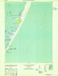
1953 Map of Whittington Point
USGS Topo · Published 1953About this map
Assateague Island is defined here by its windswept landscape of Sand Dunes and tidal marshes along the Maryland and Virginia border. The map captures a moment when human presence was focused on maritime safety and small-scale landings, notably at Pope Coast Guard Station and the isolated settlement at Scotts Landing. The intricate shoreline of Chincoteague Bay reveals a network of shallow-water features including Rum Harbor Marsh, the Pirate Islands, and Middlemoor, illustrating the complex coastal geography before major modern developments changed the barrier island's character.
Find a feature on this map
30 named features on this map. Tap any name to fly to it.
Don’t see what you’re looking for? This feature index may not catch every label — zoom into the map to look around manually.
Map Details
Editions of this 1953 Whittington Point Map
This is the sole edition of this map. No revisions or reprints were ever made.
Other maps of this area

1901 · Snow Hill
USGS Topo · 1:62,500

1901 · Green Run
USGS Topo · 1:62,500

1938 · Green Run
USGS Topo · 1:62,500

1942 · Chincoteague East
USGS Topo · 1:24,000

1942 · Tingles Island
USGS Topo · 1:24,000

1942 · Wesley
USGS Topo · 1:24,000

1943 · Boxiron
USGS Topo · 1:31,680

1943 · Whittington Point
USGS Topo · 1:31,680
1943 · Wesley
USGS Topo · 1:31,680
1943 · Chincoteague East
USGS Topo · 1:31,680