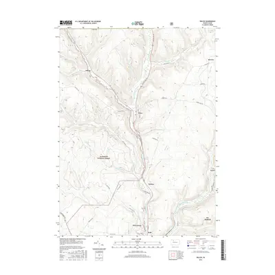
2016 Map of Wilcox
USGS Topo · Published 2016About this map
The West Branch Clarion River corridor in Elk County defines this landscape, flowing south through the valley from Wilcox toward the industrial borough of Johnsonburg. This 2016 survey documents a region where dense woodland and narrow valleys shape the pattern of settlement, with much of the western terrain protected within the Allegheny National Forest. Small hamlets and former lumber or rail points like Dahoga, Rasselas, and Ketner dot the hillsides and hollows along the river and its tributaries, including Wolf Run and Hoffman Run. In the southern portion of the map, the confluence area near Rolfe and the Wardville Cemetery provides a focal point for genealogical research. The map captures the modern road network, from Burning Well Road to Montmorenci Road, reflecting the enduring connectivity between these northern Pennsylvania communities.
Find a feature on this map
52 named features on this map. Tap any name to fly to it.
Don’t see what you’re looking for? This feature index may not catch every label — zoom into the map to look around manually.
Map Details
Editions of this 2016 Wilcox Map
This is the sole edition of this map. No revisions or reprints were ever made.
Other maps of this area

1934 · Kane
USGS Topo · 1:48,000

1935 · Mt. Jewett
USGS Topo · 1:48,000

1939 · Kane
USGS Topo · 1:62,500

1940 · Hallton
USGS Topo · 1:48,000

1940 · Mt. Jewett
USGS Topo · 1:62,500

1941 · Ridgway
USGS Topo · 1:62,500

1943 · Hallton
USGS Topo · 1:62,500

1944 · Ridgway
USGS Topo · 1:62,500

1957 · Warren
USGS Topo · 1:250,000

1958 · Warren
USGS Topo · 1:250,000
Featured Places
- Saint Marys, PA
- Wilcox, Jones Township
- Dahoga, Jones Township
- Tambine, Jones Township
- Ketner, Jones Township