2023 Map of Wilcox
USGS Topo · Published 2023About this map
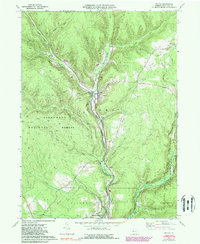
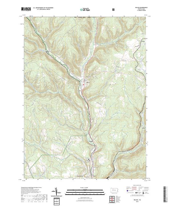
The Allegheny National Forest dominates the western portion of this Elk County landscape, where the headwaters of the Clarion River system carve through steep terrain. The settlement of Wilcox serves as a central hub, situated at the confluence of Wilson Run and the West Branch Clarion River. This area is characterized by a network of smaller runs and creeks, including Hoffman Run, Wolf Run, and Silver Creek, which have historically shaped the development of local transport and small communities.
Find a feature on this map
55 named features on this map. Tap any name to fly to it.
Don’t see what you’re looking for? This feature index may not catch every label — zoom into the map to look around manually.
Map Details
Editions of this 2023 Wilcox Map
This is the sole edition of this map. No revisions or reprints were ever made.