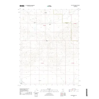
2018 Map of Wild Horse Basin
USGS Topo · Published 2018About this map
The Dead Camel Mountains and the Desert Mountains dominate this arid landscape, where the seasonal drainage of Sam Spring Wash cuts through Wild Horse Canyon. This 2018 survey captures the high-desert transition between rugged peaks and broad alluvial basins typical of the western Great Basin. In the southwest corner, the terrain drops away into Campbell Valley, where the Walker River provides a critical water source in an otherwise dry region. While much of the land is characterized by open terrain such as Wild Horse Basin and Sunshine Flat, local access is defined by limited corridors like Julian Ln. The map highlights the complex topography and the precise township and range boundaries that organize this part of Nevada.
Find a feature on this map
14 named features on this map. Tap any name to fly to it.
Don’t see what you’re looking for? This feature index may not catch every label — zoom into the map to look around manually.
Map Details
Editions of this 2018 Wild Horse Basin Map
This is the sole edition of this map. No revisions or reprints were ever made.
Other maps of this area

1891 · Wabuska
USGS Topo · 1:125,000

1894 · Wabuska
USGS Topo · 1:125,000

1908 · Carson Sink
USGS Topo · 1:250,000

1910 · Carson Sink
USGS Topo · 1:250,000

1951 · Weber Reservoir
USGS Topo · 1:62,500

1951 · Fallon
USGS Topo · 1:62,500

1957 · Wabuska
USGS Topo · 1:62,500

1957 · Silver Springs
USGS Topo · 1:62,500

1957 · Reno
USGS Topo · 1:250,000

1959 · Reno
USGS Topo · 1:250,000