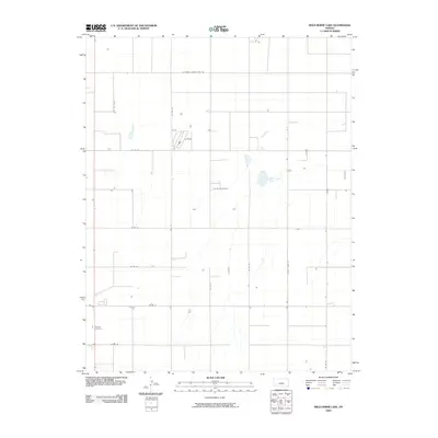
2009 Map of Wild Horse Lake
USGS Topo · Published 2009About this map
Ivanhoe Cemetery stands as a primary landmark in this southwestern Kansas landscape, marking a site of genealogical interest amid an expansive grid of rural section roads. The terrain is characterized by intermittent water features, most notably Wild Horse Lake, which provides a focal point for the surrounding plains. The map details a strictly organized agricultural infrastructure, defined by a network of thoroughfares including E Haskell County Line Rd and several lettered routes like County Road RR. This 2009 survey reveals the modern layout of rural Finney County, showing the distribution of homesteads and water management across a landscape where the section line road system dominates the geography.
Find a feature on this map
15 named features on this map. Tap any name to fly to it.
Don’t see what you’re looking for? This feature index may not catch every label — zoom into the map to look around manually.
Map Details
Editions of this 2009 Wild Horse Lake Map
This is the sole edition of this map. No revisions or reprints were ever made.
Other maps of this area

1896 · Garden
USGS Topo · 1:125,000

1955 · Dodge City
USGS Topo · 1:250,000

1958 · Dodge City
USGS Topo · 1:250,000

1959 · Dodge City
USGS Topo · 1:250,000

1959 · Garden City 3 NW
USGS Topo · 1:24,000

1959 · Garden City 3 NE
USGS Topo · 1:24,000

1960 · Garden City SW
USGS Topo · 1:24,000

1960 · Garden City 3 SW
USGS Topo · 1:24,000

1960 · Garden City 3 SE
USGS Topo · 1:24,000

1960 · Plymell
USGS Topo · 1:24,000