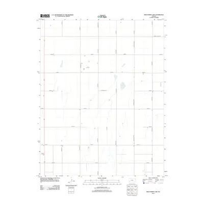
2012 Map of Wild Horse Lake
USGS Topo · Published 2012About this map
Ivanhoe sits on the western edge of this High Plains landscape, a quiet settlement centered near the Ivanhoe Cem. The terrain is defined by a rigid section-line road grid, including north-south routes like S Lightner Rd and the significant Co Road Railroad which cuts vertically through the center of the sheet. In an area dominated by agricultural geometry, the irregular basin of Wild Horse Lake provides a rare natural landmark. The map documents the boundary with the neighboring county along E Haskell Co Line Rd, marking the southern extent of Finney County. These 2012 surveys reflect the enduring structure of western Kansas township-and-range surveying, where water features like Wild Horse Lake and small community hubs like Ivanhoe remain the primary points of orientation.
Find a feature on this map
24 named features on this map. Tap any name to fly to it.
Don’t see what you’re looking for? This feature index may not catch every label — zoom into the map to look around manually.
Map Details
Editions of this 2012 Wild Horse Lake Map
This is the sole edition of this map. No revisions or reprints were ever made.
Other maps of this area

1896 · Garden
USGS Topo · 1:125,000

1955 · Dodge City
USGS Topo · 1:250,000

1958 · Dodge City
USGS Topo · 1:250,000

1959 · Dodge City
USGS Topo · 1:250,000

1959 · Garden City 3 NW
USGS Topo · 1:24,000

1959 · Garden City 3 NE
USGS Topo · 1:24,000

1960 · Garden City SW
USGS Topo · 1:24,000

1960 · Garden City 3 SW
USGS Topo · 1:24,000

1960 · Garden City 3 SE
USGS Topo · 1:24,000

1960 · Plymell
USGS Topo · 1:24,000