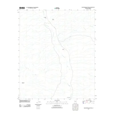
2011 Map of Wildhorse Mountain
USGS Topo · Published 2011About this map
San Pedro Valley and the course of the San Pedro River dominate this high-desert landscape in Cochise County. The topography is defined by significant elevation changes, from the prominent Wildhorse Mountain in the southwest to the constricted passage known as The Narrows in the south. Human presence is sparse but concentrated along the river corridor and established transit routes like N Cascabel Rd. Genealogists and local historians can locate the Apodaca Cemetery, situated along the winding riverbanks. The importance of water in this arid environment is evident through named features such as Palomas Spring and Diamond E Spring, which provided essential resources for early ranching and travel through Kelsey Canyon and across the Palomas Wash.
Find a feature on this map
13 named features on this map. Tap any name to fly to it.
Don’t see what you’re looking for? This feature index may not catch every label — zoom into the map to look around manually.
Map Details
Editions of this 2011 Wildhorse Mountain Map
This is the sole edition of this map. No revisions or reprints were ever made.
Other maps of this area

1943 · Dragoon
USGS Topo · 1:62,500

1943 · Winchester Mts.
USGS Topo · 1:62,500

1945 · Redington
USGS Topo · 1:62,500

1945 · Winchester Mts.
USGS Topo · 1:62,500

1945 · Happy Valley
USGS Topo · 1:62,500

1956 · Tucson
USGS Topo · 1:250,000

1957 · Redington
USGS Topo · 1:62,500

1957 · Winchester Mts.
USGS Topo · 1:62,500

1958 · Tucson
USGS Topo · 1:250,000

1958 · Happy Valley
USGS Topo · 1:62,500