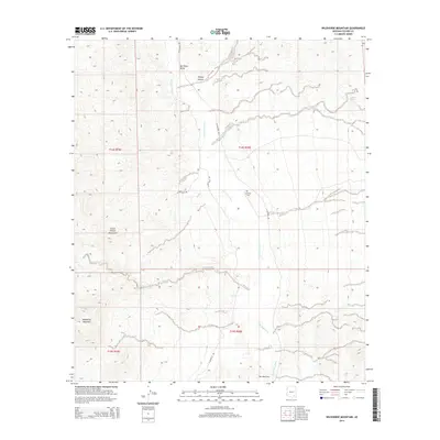
2014 Map of Wildhorse Mountain
USGS Topo · Published 2014About this map
The San Pedro River serves as the central artery of this high-desert landscape in Cochise County, cutting through the San Pedro Valley between the western Little Rincon Mountains and the prominent heights of Wildhorse Mountain. This 2014 survey documents a region defined by its hydrology and traditional transit routes, such as N Cascabel Rd which follows the river's eastern bank. Notable for local family history, the Apodaca Cem is situated on a plateau overlooking the river valley, a small human footprint in a landscape of rugged drainages like Kelsey Canyon and Palomas Wash. Toward the southern edge of the map, the terrain constricts at a feature appropriately named The Narrows, while vital water sources such as Palomas Spring and Diamond Spring are marked against the arid slopes.
Find a feature on this map
18 named features on this map. Tap any name to fly to it.
Don’t see what you’re looking for? This feature index may not catch every label — zoom into the map to look around manually.
Map Details
Editions of this 2014 Wildhorse Mountain Map
This is the sole edition of this map. No revisions or reprints were ever made.
Other maps of this area

1943 · Dragoon
USGS Topo · 1:62,500

1943 · Winchester Mts.
USGS Topo · 1:62,500

1945 · Redington
USGS Topo · 1:62,500

1945 · Winchester Mts.
USGS Topo · 1:62,500

1945 · Happy Valley
USGS Topo · 1:62,500

1956 · Tucson
USGS Topo · 1:250,000

1957 · Redington
USGS Topo · 1:62,500

1957 · Winchester Mts.
USGS Topo · 1:62,500

1958 · Tucson
USGS Topo · 1:250,000

1958 · Happy Valley
USGS Topo · 1:62,500