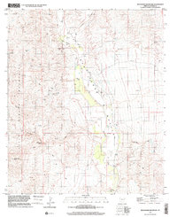
1996 Map of Wildhorse Mountain
USGS Topo · Published 2001About this map
The San Pedro Valley defines this arid landscape in Cochise County, where the perennial San Pedro River flows between the high elevations of the Rincon Mountains and Little Rincon Mountains. This late-twentieth-century study reveals a sparsely populated terrain focused on water resources and cattle ranching, marked by several wells and family-named water sources such as Diamond B Spring and Palomas Spring.
Find a feature on this map
15 named features on this map. Tap any name to fly to it.
Don’t see what you’re looking for? This feature index may not catch every label — zoom into the map to look around manually.
Map Details
Editions of this 1996 Wildhorse Mountain Map
This is the sole edition of this map. No revisions or reprints were ever made.
Other maps of this area

1943 · Dragoon
USGS Topo · 1:62,500

1943 · Winchester Mts.
USGS Topo · 1:62,500

1945 · Redington
USGS Topo · 1:62,500

1945 · Winchester Mts.
USGS Topo · 1:62,500

1945 · Happy Valley
USGS Topo · 1:62,500

1956 · Tucson
USGS Topo · 1:250,000

1957 · Redington
USGS Topo · 1:62,500

1957 · Winchester Mts.
USGS Topo · 1:62,500

1958 · Tucson
USGS Topo · 1:250,000

1958 · Happy Valley
USGS Topo · 1:62,500