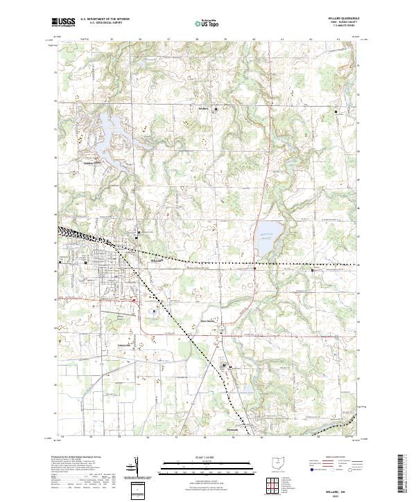
2023 Map of Willard
USGS Topo · Published 2023About this map
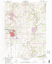
Willard serves as the industrial and transportation hub of this Huron County landscape, defined by its relationship with the B & O Railroad and the surrounding agricultural plains. The town's grid is dense with local history markers, from the Saint Josephs Ch to the Old Greenwood Cem, illustrating a settled community rooted in the early 20th century rail economy. To the south, the village of New Haven and the community of Celeryville sit amidst the headwaters of Marsh Run, an area historically significant for its specialized muck farming.
Find a feature on this map
106 named features on this map. Tap any name to fly to it.
Don’t see what you’re looking for? This feature index may not catch every label — zoom into the map to look around manually.
Map Details
Editions of this 2023 Willard Map
This is the sole edition of this map. No revisions or reprints were ever made.