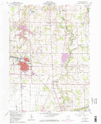
1960 Map of Willard
USGS Topo · Published 1973About this map
Willard serves as the industrial and transit anchor for this portion of North Central Ohio, defined by the heavy infrastructure of the Baltimore and Ohio railroad. This network branches through the landscape, connecting the urban center to outlying agricultural communities such as New Haven, Steuben, and Celeryville. The topography is marked by the winding paths of the Huron River and its West Branch, which provide the drainage for the surrounding township lands. Residential and civic life is anchored by landmarks like St Josephs Ch, the local High Sch, and the Willard Airport. To the south, the village of Plymouth sits along the rail lines, while smaller clusters like Guinea Corners and Boughtonville dot the eastern rural landscape. For those researching family history, the map includes significant sites such as Greenwood Cem, Maple Grove Cem, and Hoyt Cem.
Find a feature on this map
68 named features on this map. Tap any name to fly to it.
Don’t see what you’re looking for? This feature index may not catch every label — zoom into the map to look around manually.
Map Details
Editions of this 1960 Willard Map
3 editions found
Other maps of this area

1915 · Norwalk
USGS Topo · 1:62,500

1915 · Siam
USGS Topo · 1:62,500

1915 · Bucyrus
USGS Topo · 1:62,500

1915 · Crestline
USGS Topo · 1:62,500

1943 · Bucyrus
USGS Topo · 1:62,500

1943 · Crestline
USGS Topo · 1:62,500

1944 · Norwalk
USGS Topo · 1:62,500

1950 · Marion
USGS Topo · 1:250,000

1956 · Toledo
USGS Topo · 1:250,000

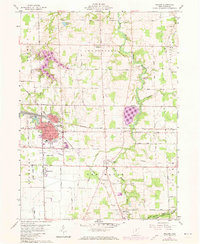
1960 · Willard
USGS Topo · 1:24,000