
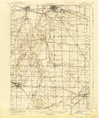
1915 Map of Norwalk
USGS Topo · Published 1936About this map
The Huron River and its numerous tributaries, including Frink Run and Slate Run, carve a complex drainage pattern across this Huron County landscape. Norwalk serves as the regional hub, where the Wheeling and Lake Erie and the Lake Shore and Michigan Southern railroads intersect. The presence of the County Infirmary and a dense network of numbered rural schools, such as School No 10 and School No 6, reflects the organized civic structure of the early twentieth century. Further south, the map documents the growth of Chicago Junction, a vital rail center for the Baltimore and Ohio and the Northern Ohio lines. The specialized agriculture of the region is evident in the naming of Celeryville, while dozens of smaller settlements like Standardsburg, Steuben, and Hanville Corners are linked by an evolving network of early Electric railways.
Find a feature on this map
76 named features on this map. Tap any name to fly to it.
Don’t see what you’re looking for? This feature index may not catch every label — zoom into the map to look around manually.
Map Details
Editions of this 1915 Norwalk Map
2 editions found
Other maps of this area

1901 · Bellevue
USGS Topo · 1:62,500

1903 · Bellevue
USGS Topo · 1:62,500

1903 · Vermilion
USGS Topo · 1:62,500

1904 · Sandusky
USGS Topo · 1:62,500

1908 · Ashland
USGS Topo · 1:62,500

1908 · New London
USGS Topo · 1:62,500

1915 · Siam
USGS Topo · 1:62,500

1915 · Bucyrus
USGS Topo · 1:62,500

1915 · Crestline
USGS Topo · 1:62,500

1943 · Bucyrus
USGS Topo · 1:62,500