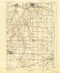
1915 Map of Norwalk
USGS Topo · Published 1943About this map
The Huron River and its various forks carve through the agricultural heart of Huron County, anchoring a landscape defined by its early 20th-century rail infrastructure. Industrial and civic development is centered in Norwalk, which features the County Infirmary and a dense hub of transit including the Wheeling and Lake Erie RR and the Lake Shore and Michigan Southern RR. To the south, the rail junction at Chicago Junction serves as a vital point of commerce near the sprawling marshlands of Celeryville and New Haven. The map reveals a dense network of local education, with dozens of numbered rural schoolhouses such as School No 6 and School No 10 serving scattered farming communities like Steuben and Havana. This pre-war landscape highlights the transition from isolated rural townships to a connected regional economy driven by steam and steel.
Find a feature on this map
66 named features on this map. Tap any name to fly to it.
Don’t see what you’re looking for? This feature index may not catch every label — zoom into the map to look around manually.
Map Details
Editions of this 1915 Norwalk Map
2 editions found
Other maps of this area

1901 · Bellevue
USGS Topo · 1:62,500

1903 · Bellevue
USGS Topo · 1:62,500

1903 · Vermilion
USGS Topo · 1:62,500

1904 · Sandusky
USGS Topo · 1:62,500

1908 · Ashland
USGS Topo · 1:62,500

1908 · New London
USGS Topo · 1:62,500

1915 · Norwalk
USGS Topo · 1:62,500

1915 · Siam
USGS Topo · 1:62,500

1915 · Bucyrus
USGS Topo · 1:62,500

1915 · Crestline
USGS Topo · 1:62,500