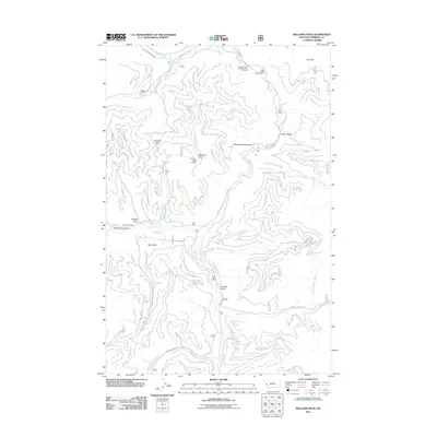
2011 Map of Williams Peak
USGS Topo · Published 2011About this map
Williams Peak and its high-elevation fire tower, the Williams Peak Lookout, anchor this stretch of the Bitterroot Mountains in Mineral County. The terrain is defined by a dense network of watercourses and gulches, including Slaughterhouse Gulch and Camillia Gulch, which feed into the central Fish Creek system. A prominent point of interest identifies the Largest Pine in Montana, located north of the Big Pine Campground along the waterway. At the northern edge, the Clark Fork river cuts through the landscape near the confluence with Rock Creek. This area preserves evidence of early mountain industry and recreation, from the Fish Creek Mine situated near Winkler Gulch to the seasonal dwellings at Helean Camp. The map provides a detailed look at the Forest Service road network, such as Fish Creek Rd and Thompson Creek Rd, which navigate the steep transition between peaks and river flats.
Find a feature on this map
39 named features on this map. Tap any name to fly to it.
Don’t see what you’re looking for? This feature index may not catch every label — zoom into the map to look around manually.
Map Details
Editions of this 2011 Williams Peak Map
This is the sole edition of this map. No revisions or reprints were ever made.
Other maps of this area

1911 · Lolo
USGS Topo · 1:250,000

1913 · Lolo
USGS Topo · 1:250,000

1956 · Wallace
USGS Topo · 1:250,000

1956 · Hamilton
USGS Topo · 1:250,000

1959 · Hamilton
USGS Topo · 1:250,000

1959 · Tarkio
USGS Topo · 1:62,500

1960 · Wallace
USGS Topo · 1:250,000

1960 · Hamilton
USGS Topo · 1:250,000

1960 · Superior
USGS Topo · 1:62,500

1960 · Straight Peak
USGS Topo · 1:62,500