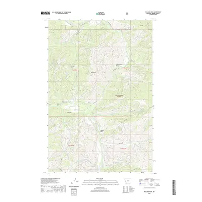
2020 Map of Williams Peak
USGS Topo · Published 2020About this map
Lolo National Forest encompasses this high-elevation terrain in Mineral County, centered on the prominent Williams Peak. The landscape is defined by a complex drainage system where Fish Creek and the S Fork Fish Cr collect runoff from numerous steep ravines, including the ominously named Slaughterhouse Gulch and Ruben Gulch. These waterways carve through a series of summits such as Rivulet Peak, Cyr Peak, and Bear Point, illustrating the challenging topography of the northern Rockies.
Find a feature on this map
39 named features on this map. Tap any name to fly to it.
Don’t see what you’re looking for? This feature index may not catch every label — zoom into the map to look around manually.
Map Details
Editions of this 2020 Williams Peak Map
This is the sole edition of this map. No revisions or reprints were ever made.
Other maps of this area

1911 · Lolo
USGS Topo · 1:250,000

1913 · Lolo
USGS Topo · 1:250,000

1956 · Wallace
USGS Topo · 1:250,000

1956 · Hamilton
USGS Topo · 1:250,000

1959 · Hamilton
USGS Topo · 1:250,000

1959 · Tarkio
USGS Topo · 1:62,500

1960 · Wallace
USGS Topo · 1:250,000

1960 · Hamilton
USGS Topo · 1:250,000

1960 · Superior
USGS Topo · 1:62,500

1960 · Straight Peak
USGS Topo · 1:62,500