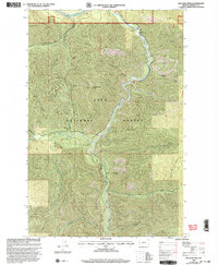
1999 Map of Williams Peak
USGS Topo · Published 2003About this map
Lolo National Forest dominates this landscape in Mineral County, centered on the drainage basin of Fish Creek as it flows toward the Clark Fork river. The 1999 revision shows a rugged interior defined by steep ridges and deep gulches, where the high point at Williams Peak Lookout stands as a primary vantage over the surrounding territory. This portion of the forest is carved by an intricate network of waterways, including the West Fork Fish Creek and South Fork Fish Creek, which converge near the Forks Fishing Access.
Find a feature on this map
32 named features on this map. Tap any name to fly to it.
Don’t see what you’re looking for? This feature index may not catch every label — zoom into the map to look around manually.
Map Details
Editions of this 1999 Williams Peak Map
This is the sole edition of this map. No revisions or reprints were ever made.
Other maps of this area

1911 · Lolo
USGS Topo · 1:250,000

1913 · Lolo
USGS Topo · 1:250,000

1956 · Wallace
USGS Topo · 1:250,000

1956 · Hamilton
USGS Topo · 1:250,000

1959 · Hamilton
USGS Topo · 1:250,000

1959 · Tarkio
USGS Topo · 1:62,500

1960 · Wallace
USGS Topo · 1:250,000

1960 · Hamilton
USGS Topo · 1:250,000

1960 · Superior
USGS Topo · 1:62,500

1960 · Straight Peak
USGS Topo · 1:62,500