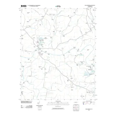
2010 Map of Williamsport
USGS Topo · Published 2010About this map
The Duck River meanders across this Maury County landscape, flanked by a series of bluffs and islands including Bratton Bluff, Dorsett Island, and Cave Bluff. This area south of the Natchez Trace Pkwy reveals a significant industrial footprint from the mid-to-late 20th century, dominated by extensive chemical processing and mining operations. Multiple industrial impoundments like Hooker Chemical Pond A and Monsanto Tailings Pond Number Nine sit alongside the Harlan Kelley Mine, illustrating the intense resource extraction near the riverbanks.
Find a feature on this map
140 named features on this map. Tap any name to fly to it.
Don’t see what you’re looking for? This feature index may not catch every label — zoom into the map to look around manually.
Map Details
Editions of this 2010 Williamsport Map
This is the sole edition of this map. No revisions or reprints were ever made.
Other maps of this area

1901 · Colombia
USGS Topo · 1:125,000

1936 · Godwin
USGS Topo · 1:24,000

1936 · Williamsport
USGS Topo · 1:24,000

1936 · Primm
USGS Topo · 1:24,000

1936 · Mt Joy
USGS Topo · 1:24,000

1936 · Littlelot
USGS Topo · 1:24,000

1936 · Theta
USGS Topo · 1:24,000

1936 · Greenfield Bend
USGS Topo · 1:24,000

1936 · Mount Pleasant
USGS Topo · 1:24,000

1936 · Columbia
USGS Topo · 1:24,000