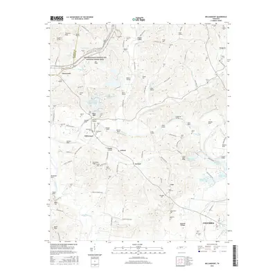
2016 Map of Williamsport
USGS Topo · Published 2016About this map
Duck River winds through the heart of Maury County, defining the landscape around Williamsport and Santa Fe. This area is characterized by high bluffs and numerous creek valleys, such as Poplar Creek and Greenlick Creek, which shaped early Tennessee settlement patterns. The map documents a historical landscape transition, evidenced by the proximity of heritage sites like Fikes Mill and Foster Chapel to mid-century industrial features like the Hooker Chemical Ponds. To the north, the Natchez Trace Parkway and National Scenic Trail follows the ancient ridge-top route, passing landmarks such as Akin Ridge. Genealogy researchers will find significant value in the dense distribution of family-named cemeteries, including the McKennon and Pollard burial grounds, which anchor the history of rural communities like Sawdust and Arkland.
Find a feature on this map
145 named features on this map. Tap any name to fly to it.
Don’t see what you’re looking for? This feature index may not catch every label — zoom into the map to look around manually.
Map Details
Editions of this 2016 Williamsport Map
This is the sole edition of this map. No revisions or reprints were ever made.
Other maps of this area

1901 · Colombia
USGS Topo · 1:125,000

1936 · Godwin
USGS Topo · 1:24,000

1936 · Williamsport
USGS Topo · 1:24,000

1936 · Primm
USGS Topo · 1:24,000

1936 · Mt Joy
USGS Topo · 1:24,000

1936 · Littlelot
USGS Topo · 1:24,000

1936 · Theta
USGS Topo · 1:24,000

1936 · Greenfield Bend
USGS Topo · 1:24,000

1936 · Mount Pleasant
USGS Topo · 1:24,000

1936 · Columbia
USGS Topo · 1:24,000