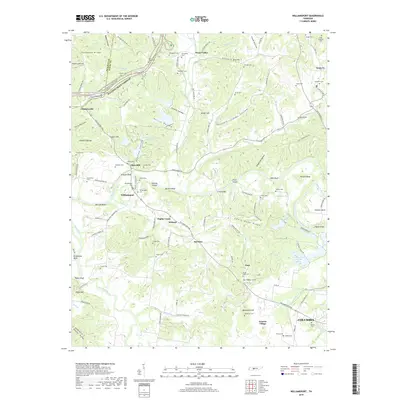
2019 Map of Williamsport
USGS Topo · Published 2019About this map
The Duck River carves a winding path through the center of this Maury County landscape, defining the rural character of communities like Williamsport and Santa Fe. The historical footprint of the region is evident in the high density of family and community burial grounds, including Akin Ridge Cem, Alexander Cem, and Pollard Cem. Along the river, prominent landmarks such as Bratton Bluff and Cave Bluff overlook the water, while the modern Natchez Trace Parkway and the Natchez Trace National Scenic Trail follow the high ridges in the northwest, tracing a path through Chartersville.
Find a feature on this map
125 named features on this map. Tap any name to fly to it.
Don’t see what you’re looking for? This feature index may not catch every label — zoom into the map to look around manually.
Map Details
Editions of this 2019 Williamsport Map
This is the sole edition of this map. No revisions or reprints were ever made.
Other maps of this area

1901 · Colombia
USGS Topo · 1:125,000

1936 · Godwin
USGS Topo · 1:24,000

1936 · Williamsport
USGS Topo · 1:24,000

1936 · Primm
USGS Topo · 1:24,000

1936 · Mt Joy
USGS Topo · 1:24,000

1936 · Littlelot
USGS Topo · 1:24,000

1936 · Theta
USGS Topo · 1:24,000

1936 · Greenfield Bend
USGS Topo · 1:24,000

1936 · Mount Pleasant
USGS Topo · 1:24,000

1936 · Columbia
USGS Topo · 1:24,000