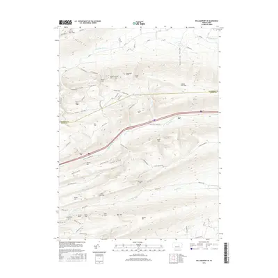
2016 Map of Williamsport SE
USGS Topo · Published 2016About this map
Buffalo Mtn and the surrounding ridges of the Appalachian Mountains dominate this 2016 landscape, where the border between Lycoming and Union counties follows the high crests of the Bald Eagle State Forest. The area is defined by its deep gaps and hollows, including the prominent Beartrap Hollow and Cowbell Hollow. Water travels through the narrow valleys via White Deer Cr and Spruce Run, eventually feeding the Spruce Run Reservoir in the southeast.
Find a feature on this map
74 named features on this map. Tap any name to fly to it.
Don’t see what you’re looking for? This feature index may not catch every label — zoom into the map to look around manually.
Map Details
Editions of this 2016 Williamsport SE Map
This is the sole edition of this map. No revisions or reprints were ever made.
Other maps of this area

1893 · Sunbury
USGS Topo · 1:62,500

1921 · Williamsport
USGS Topo · 1:48,000

1923 · Williamsport
USGS Topo · 1:62,500

1924 · Milton
USGS Topo · 1:62,500

1938 · Mifflinburg
USGS Topo · 1:48,000

1943 · Sunbury
USGS Topo · 1:62,500

1943 · Mifflinburg
USGS Topo · 1:62,500

1944 · Williamsport
USGS Topo · 1:62,500

1950 · Harrisburg
USGS Topo · 1:250,000
1953 · Mifflinburg
USGS Topo · 1:62,500
Featured Places
- White Deer Township, PA
- Buffalo Township, PA
- Washington Township, PA
- Lewis Township, PA
- Limestone Township, PA