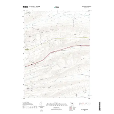
2019 Map of Williamsport SE
USGS Topo · Published 2019About this map
White Deer Valley and the surrounding ridges of the Appalachian Mountains dominate this 2019 survey of the Lycoming and Union County border. The landscape is defined by its series of gaps and hollows, where drainages like White Deer Cr and Spruce Run have carved paths through the high ground of Nittany Mtn and Buffalo Mtn. This area represents a deeply corrugated section of the Pennsylvania wilds, where traditional mountain passes like Running Gap and Stony Gap provided essential transit routes through the otherwise formidable terrain of South White Deer Ridge. Local nomenclature is well-preserved across the ridges, with family-named or descriptive landmarks such as Shoemaker Knob, Potato Hill, and Cowbell Hollow identifying specific folds in the topography. Modern infrastructure is visible where the Interstate 80 corridor traverses Lyman Gap, cutting across a terrain otherwise characterized by a dense network of forest roads and hiking paths like the Webster Trail and 5 Points Trail.
Find a feature on this map
73 named features on this map. Tap any name to fly to it.
Don’t see what you’re looking for? This feature index may not catch every label — zoom into the map to look around manually.
Map Details
Editions of this 2019 Williamsport SE Map
This is the sole edition of this map. No revisions or reprints were ever made.
Other maps of this area

1893 · Sunbury
USGS Topo · 1:62,500

1921 · Williamsport
USGS Topo · 1:48,000

1923 · Williamsport
USGS Topo · 1:62,500

1924 · Milton
USGS Topo · 1:62,500

1938 · Mifflinburg
USGS Topo · 1:48,000

1943 · Sunbury
USGS Topo · 1:62,500

1943 · Mifflinburg
USGS Topo · 1:62,500

1944 · Williamsport
USGS Topo · 1:62,500

1950 · Harrisburg
USGS Topo · 1:250,000
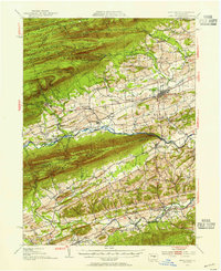
1953 · Mifflinburg
USGS Topo · 1:62,500
Featured Places
- White Deer Township, PA
- Buffalo Township, PA
- Washington Township, PA
- Lewis Township, PA
- Limestone Township, PA