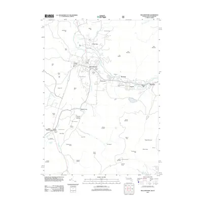
2012 Map of Williamstown
USGS Topo · Published 2012About this map
The Hoosic River valley serves as the central corridor for this 2012 study of Williamstown, where the confluence with the Green River and Hemlock Brook historically shaped the region's development. Centered on Williamstown and the campus of Williams College, the map illustrates a landscape where academic and residential centers meet the rising terrain of the Greylock Range. In the east, the settlements of Meadowvale, Blackinton, and Braytonville follow the river and rail path toward North Adams, while the southern reaches move into agricultural and conservation lands like Green River Farms and Bacons Farm. Significant local landmarks include the Harriman-and-West Airport and the Taconic Golf Course, while the northern border is defined by Northwest Hill and Mason Hill. This contemporary survey provides a clear view of the modern road network connecting established neighborhoods with the preserved wilderness of Mount Greylock.
Find a feature on this map
66 named features on this map. Tap any name to fly to it.
Don’t see what you’re looking for? This feature index may not catch every label — zoom into the map to look around manually.
Map Details
Editions of this 2012 Williamstown Map
This is the sole edition of this map. No revisions or reprints were ever made.
Other maps of this area

1886 · Greylock
USGS Topo · 1:62,500

1888 · Berlin
USGS Topo · 1:62,500

1890 · Berlin
USGS Topo · 1:62,500

1891 · Greylock
USGS Topo · 1:62,500

1893 · Greylock
USGS Topo · 1:62,500

1894 · Berlin
USGS Topo · 1:62,500

1897 · Hoosick
USGS Topo · 1:62,500

1898 · Berlin
USGS Topo · 1:62,500

1898 · Bennington
USGS Topo · 1:62,500

1898 · Greylock
USGS Topo · 1:62,500