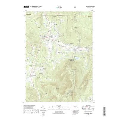
2018 Map of Williamstown
USGS Topo · Published 2018About this map
Williams College forms the cultural heart of this Northern Berkshire landscape, surrounded by the historic residential centers of Williamstown and White Oaks. The topography is dominated by the massif of the Greylock Range, culminating at the summit of Mt Greylock, the highest point in the state. The Hoosic River cuts through the northern valley, a corridor shared by industry and infrastructure near Blackinton and Braytonville. Hikers will find the long-distance Appalachian National Scenic Trail winding across the high ridges of Mt Williams, Mt Fitch, and Mt Prospect. To the south, the terrain descends into the pastoral valley of South Williamstown, where the W Br Green River flows past Southlawn Cem. This map details a high-elevation environment where institutional life, protected forests like the Green Mountain National Forest, and municipal resources like the Williamstown Reservoir coexist within a complex alpine geography.
Find a feature on this map
78 named features on this map. Tap any name to fly to it.
Don’t see what you’re looking for? This feature index may not catch every label — zoom into the map to look around manually.
Map Details
Editions of this 2018 Williamstown Map
This is the sole edition of this map. No revisions or reprints were ever made.
Other maps of this area

1886 · Greylock
USGS Topo · 1:62,500

1888 · Berlin
USGS Topo · 1:62,500

1890 · Berlin
USGS Topo · 1:62,500

1891 · Greylock
USGS Topo · 1:62,500

1893 · Greylock
USGS Topo · 1:62,500

1894 · Berlin
USGS Topo · 1:62,500

1897 · Hoosick
USGS Topo · 1:62,500

1898 · Berlin
USGS Topo · 1:62,500

1898 · Bennington
USGS Topo · 1:62,500

1898 · Greylock
USGS Topo · 1:62,500