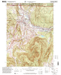
1997 Map of Williamstown
USGS Topo · Published 2000About this map
Mt Greylock State Reservation anchors the southern half of this landscape, dominated by the massif of Mt Greylock (War Memorial Beacon) and its surrounding peaks. The map reveals a high-elevation network of recreational and historical routes, including the Appalachian Trail, which traverses the ridge near Mt Fitch and Mt Williams. In the valley below, the urban and academic character of Williamstown is defined by the campus of Williams College and the confluence of the Hoosic River and Green River.
Find a feature on this map
81 named features on this map. Tap any name to fly to it.
Don’t see what you’re looking for? This feature index may not catch every label — zoom into the map to look around manually.
Map Details
Editions of this 1997 Williamstown Map
This is the sole edition of this map. No revisions or reprints were ever made.
Other maps of this area

1886 · Greylock
USGS Topo · 1:62,500

1888 · Berlin
USGS Topo · 1:62,500

1890 · Berlin
USGS Topo · 1:62,500

1891 · Greylock
USGS Topo · 1:62,500

1893 · Greylock
USGS Topo · 1:62,500

1894 · Berlin
USGS Topo · 1:62,500

1897 · Hoosick
USGS Topo · 1:62,500

1898 · Berlin
USGS Topo · 1:62,500

1898 · Bennington
USGS Topo · 1:62,500

1898 · Greylock
USGS Topo · 1:62,500