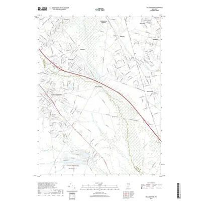
2019 Map of Williamstown
USGS Topo · Published 2019About this map
The Great Egg Harbor River carves a winding path through this New Jersey landscape, defining the character of the Pine Barrens fringe. This 2019 survey captures the developed suburbs of Williamstown and Sicklerville as they meet the expansive wetlands and pine-oak forests to the east. The map illustrates a dense network of residential streets and arterial roads like the Atlantic City Expressway, which cuts across the drainage basins of Fourmile Branch and Ducks Nest Stream. A legacy of smaller communities remains visible along the rail corridors and older county routes, including Cedar Brook, Braddock, and Blue Anchor. Local history is anchored by sites such as Hopewell Cem and the waters of New Brooklyn Lake. In the southern reach, the landscape transitions toward the wetlands of Hospitality Branch and the recreational waters of Victory Lakes, highlighting the region's reliance on its diverse aquatic geography.
Find a feature on this map
254 named features on this map. Tap any name to fly to it.
Don’t see what you’re looking for? This feature index may not catch every label — zoom into the map to look around manually.
Map Details
Editions of this 2019 Williamstown Map
This is the sole edition of this map. No revisions or reprints were ever made.
Other maps of this area

1888 · Mount Holly
USGS Topo · 1:62,500

1890 · Hammonton
USGS Topo · 1:62,500

1890 · Glassboro
USGS Topo · 1:62,500

1891 · Philadelphia
USGS Topo · 1:62,500

1894 · Hammonton
USGS Topo · 1:62,500

1894 · Mount Holly
USGS Topo · 1:62,500

1894 · Philadelphia
USGS Topo · 1:62,500

1896 · Philadelphia
USGS Topo · 1:62,500

1898 · Glassboro
USGS Topo · 1:62,500

1898 · Philadelphia
USGS Topo · 1:62,500
Featured Places
- Sicklerville, Winslow Township
- Winslow Township, NJ
- Monroe Township, NJ
- Williamstown, Monroe Township
- Chesilhurst, NJ