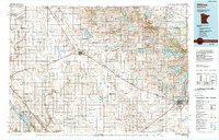
1986 Map of Willmar
USGS Topo · Published 1989About this map
Willmar serves as the regional hub in this mid-1980s landscape, where the prairie grid meets a dense network of glacial lakes and river valleys. The western half of the map is defined by the winding paths of the Chippewa River and the Pomme de Terre River, while the southern reaches follow the broad valley of the Minnesota River near Lac qui Parle State Recreation Area. Small agricultural settlements like Benson, Kerkhoven, and Clontarf are positioned along the rail lines that cut diagonally across the terrain.
Find a feature on this map
121 named features on this map. Tap any name to fly to it.
Don’t see what you’re looking for? This feature index may not catch every label — zoom into the map to look around manually.
Map Details
Editions of this 1986 Willmar Map
2 editions found
Other maps of this area

1910 · Chokio
USGS Topo · 1:62,500

1912 · Chokio
USGS Topo · 1:62,500

1912 · Morris
USGS Topo · 1:62,500

1953 · Milbank
USGS Topo · 1:250,000

1953 · Watertown
USGS Topo · 1:250,000

1953 · New Ulm
USGS Topo · 1:250,000

1953 · Saint Cloud
USGS Topo · 1:250,000

1956 · Atwater
USGS Topo · 1:62,500

1957 · Saint Cloud
USGS Topo · 1:250,000

1957 · New Ulm
USGS Topo · 1:250,000