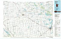
1986 Map of Willmar
USGS Topo · Published 1986About this map
The Chippewa River and its East Branch carve through the glacial till of west-central Minnesota, defining a landscape of prairie wetlands and intensive agriculture. This mid-1980s record captures a region anchored by Willmar and Benson, where the Burlington Northern railroad lines dictated the placement of grain-handling settlements like De Graff, Murdock, and Pennock.
Find a feature on this map
151 named features on this map. Tap any name to fly to it.
Don’t see what you’re looking for? This feature index may not catch every label — zoom into the map to look around manually.
Map Details
Editions of this 1986 Willmar Map
2 editions found
Other maps of this area

1910 · Chokio
USGS Topo · 1:62,500

1912 · Chokio
USGS Topo · 1:62,500

1912 · Morris
USGS Topo · 1:62,500

1953 · Milbank
USGS Topo · 1:250,000

1953 · Watertown
USGS Topo · 1:250,000

1953 · New Ulm
USGS Topo · 1:250,000

1953 · Saint Cloud
USGS Topo · 1:250,000

1956 · Atwater
USGS Topo · 1:62,500

1957 · Saint Cloud
USGS Topo · 1:250,000

1957 · New Ulm
USGS Topo · 1:250,000