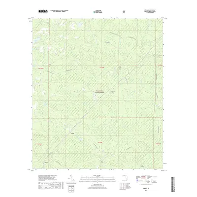
2018 Map of Wilma
USGS Topo · Published 2018About this map
Apalachicola National Forest dominates this section of Liberty County, where the landscape is defined by a complex network of bays, swamps, and creek systems. Small settlements such as Wilma, Central City, Vilas, and Kern are scattered through the timberlands, connected primarily by forest roads like National Forest Rd 118. This survey highlights the intricate drainage of the New River basin, featuring numerous swampy depressions like Whitehead Swamp and Lindsey Bay. Local history and genealogy interest is concentrated at the Nixon Garden Cem and several historic crossing points, including Burnt Bridge and Cliff Bridge. The Florida National Scenic Trail winds through the northern portion of the map, providing a path through the dense wetlands of Devils Swamp and Shuler Bay, illustrating the preservation of this Florida wilderness in the early 21st century.
Find a feature on this map
47 named features on this map. Tap any name to fly to it.
Don’t see what you’re looking for? This feature index may not catch every label — zoom into the map to look around manually.
Map Details
Editions of this 2018 Wilma Map
This is the sole edition of this map. No revisions or reprints were ever made.
Other maps of this area

1944 · Queens Bay
USGS Topo · 1:24,000

1945 · Kennedy Creek
USGS Topo · 1:31,680

1945 · Estiffanulga
USGS Topo · 1:31,680

1945 · Orange
USGS Topo · 1:31,680

1945 · Woods
USGS Topo · 1:31,680

1945 · Telogia
USGS Topo · 1:24,000

1946 · Queens Bay
USGS Topo · 1:31,680

1946 · Sumatra
USGS Topo · 1:31,680

1946 · Telogia
USGS Topo · 1:31,680

1946 · Owens Bridge
USGS Topo · 1:31,680