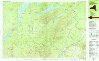
1978 Map of Wilmington
USGS Topo · Published 1979About this map
Whiteface Mountain dominates the southern landscape of this 1978 survey, with the Whiteface Memorial Highway winding up its slopes toward the summit. The area is characterized by the intersection of the Stephenson Range, Wilmington Range, and Black Mountain Range, creating a complex network of peaks and valleys within the Adirondack Park. Settled areas like Wilmington and the whimsically named North Pole sit near the West Branch Ausable River, while the northern portion of the map is defined by the expansive Union Falls Pond and Taylor Pond.
Find a feature on this map
93 named features on this map. Tap any name to fly to it.
Don’t see what you’re looking for? This feature index may not catch every label — zoom into the map to look around manually.
Map Details
Editions of this 1978 Wilmington Map
This is the sole edition of this map. No revisions or reprints were ever made.
Other maps of this area

1893 · Troy
USGS Topo · 1:62,500

1893 · Coxsackie
USGS Topo · 1:62,500

1893 · Durham
USGS Topo · 1:62,500

1893 · Albany
USGS Topo · 1:62,500

1894 · Coxsackie
USGS Topo · 1:62,500

1894 · Durham
USGS Topo · 1:62,500

1895 · Troy
USGS Topo · 1:62,500

1895 · Albany
USGS Topo · 1:62,500

1898 · Albany
USGS Topo · 1:62,500

1898 · Troy
USGS Topo · 1:62,500