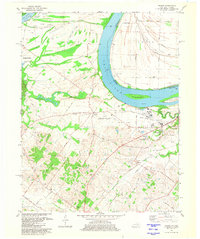
1981 Map of Wilson
USGS Topo · Published 1981About this map
The Ohio River carves a massive bend through this Kentucky and Indiana borderland, defining a landscape of low-lying wetlands and heavy industrial activity. The northern reaches are dominated by the complex hydrology of the Sloughs Wildlife Management Area, where features like Deep Slough, Grassy Pond Slough, and Little Cypress Slough reveal the ancestral wandering of the river channel. This area contrast sharply with the industrial and educational development further south, anchored by the Henderson Community College and the Henderson City County Airport.
Find a feature on this map
52 named features on this map. Tap any name to fly to it.
Don’t see what you’re looking for? This feature index may not catch every label — zoom into the map to look around manually.
Map Details
Editions of this 1981 Wilson Map
2 editions found
Other maps of this area

1906 · Sebree
USGS Topo · 1:62,500

1907 · Morganfield
USGS Topo · 1:62,500

1914 · Henderson
USGS Topo · 1:48,000

1916 · Henderson
USGS Topo · 1:62,500

1917 · Uniontown
USGS Topo · 1:62,500

1949 · Poole
USGS Topo · 1:24,000

1949 · Robards
USGS Topo · 1:24,000

1951 · Poole
USGS Topo · 1:24,000

1951 · Waverly
USGS Topo · 1:24,000

1951 · Robards
USGS Topo · 1:24,000