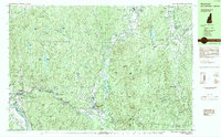
1984 Map of Winchester
USGS Topo · Published 1984About this map
The Ashuelot River winds through the heart of this Cheshire County landscape, anchoring a series of industrial and residential corridors at the turn of the 1980s. The Boston and Maine Railroad traces the river valley, connecting the established centers of Winchester, Ashuelot, and Westport. This transport corridor contrasts with the high, wooded ground of the Pisgah Mountain Range to the west, where Pisgah State Park preserves a rugged interior dotted with water bodies like Pisgah Reservoir and Kilburn Pond. In the eastern portion of the map, the township of Swanzey is characterized by a mix of small settlements including West Swanzey and East Swanzey, oriented around the river and Swanzey Lake. Local genealogy is well-supported by the mapping of St Josephs Cem, Evergreen Cem, and Pine Grove Cem, alongside civic landmarks like the Thayer Sch and Meetinghouse Hill.
Find a feature on this map
98 named features on this map. Tap any name to fly to it.
Don’t see what you’re looking for? This feature index may not catch every label — zoom into the map to look around manually.
Map Details
Editions of this 1984 Winchester Map
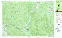
2 editions found
Other maps of this area

1887 · Warwick
USGS Topo · 1:62,500

1887 · Winchendon
USGS Topo · 1:62,500

1889 · Warwick
USGS Topo · 1:62,500

1890 · Greenfield
USGS Topo · 1:62,500

1890 · Winchendon
USGS Topo · 1:62,500

1891 · Brattleboro
USGS Topo · 1:62,500

1893 · Brattleboro
USGS Topo · 1:62,500

1894 · Winchendon
USGS Topo · 1:62,500

1894 · Greenfield
USGS Topo · 1:62,500

1894 · Warwick
USGS Topo · 1:62,500