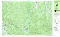
1984 Map of Winchester
USGS Topo · Published 1984About this map
The Ashuelot River carves a deep valley through the southwestern corner of Cheshire County, anchoring the industrial and residential centers of Winchester, Ashuelot, and Hinsdale. This mid-1980s topographic portrait captures a region defined by the contrast between its narrow river-bottom settlements and the massive, wooded expanse of Pisgah State Park. To the west, the Connecticut River serves as the state boundary near Dole Junction, while the northern and eastern portions of the map are dominated by the Pisgah Mountain Range and Franconia Mountain Range.
Find a feature on this map
84 named features on this map. Tap any name to fly to it.
Don’t see what you’re looking for? This feature index may not catch every label — zoom into the map to look around manually.
Map Details
Editions of this 1984 Winchester Map
2 editions found
Other maps of this area

1887 · Warwick
USGS Topo · 1:62,500

1887 · Winchendon
USGS Topo · 1:62,500

1889 · Warwick
USGS Topo · 1:62,500

1890 · Greenfield
USGS Topo · 1:62,500

1890 · Winchendon
USGS Topo · 1:62,500

1891 · Brattleboro
USGS Topo · 1:62,500

1893 · Brattleboro
USGS Topo · 1:62,500

1894 · Winchendon
USGS Topo · 1:62,500

1894 · Greenfield
USGS Topo · 1:62,500

1894 · Warwick
USGS Topo · 1:62,500