2023 Map of Wind Ridge
USGS Topo · Published 2023About this map
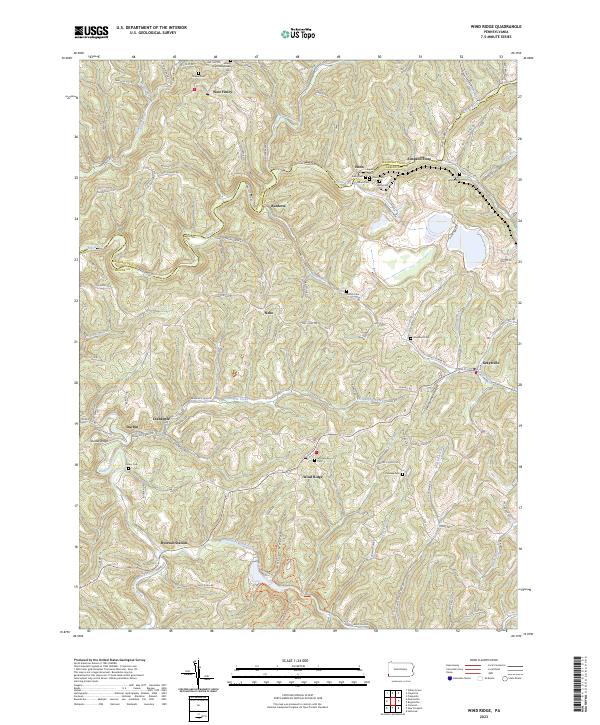
Wind Ridge and the surrounding borderlands of Greene and Washington Counties showcase a landscape defined by sharp ridges and deep hollows, such as Polly Hollow and Zimmerman Hollow. The topography here has long dictated the layout of small crossroads communities and family farmsteads. Significant industrial presence is found at the Bailey Mine, while the area's social fabric is evidenced by numerous historic burial grounds including Enon Cem, Jacksonville Cem, and Lazear Cem. The complex drainage system of the Dunkard Fork and Enlow Fork provides the primary orientation for the local road network, which winds through high elevations like Dodds Ridge. Small settlements such as Simpson Store, Ryerson Station, and Nebo remain as anchors in this rural expanse, preserving the naming conventions of early settler families and long-standing community centers like Gap Presbyterian church.
Find a feature on this map
100 named features on this map. Tap any name to fly to it.
Don’t see what you’re looking for? This feature index may not catch every label — zoom into the map to look around manually.
Map Details
Editions of this 2023 Wind Ridge Map
This is the sole edition of this map. No revisions or reprints were ever made.
Historical Maps of Morris Township Through Time
3 maps found
Featured Locations
- Morris Township, PA
- Center Township, PA
- East Finley Township, PA
- West Finley Township, PA
- Enon, East Finley Township