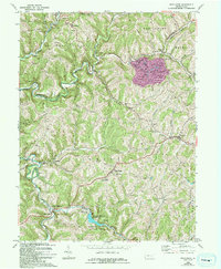
1964 Map of Wind Ridge
USGS Topo · Published 1994About this map
The hills of Greene and Washington counties are defined by a complex network of branching waterways like Enlow Fork and Dunkard Fork, which shaped the early agricultural and industrial settlement patterns of southwestern Pennsylvania. In the southern half of the quadrangle, the Ryerson Station Reservoir and Ryerson Station State Park serve as major landmarks, preserving the area around the old settlement of Ryerson Station.
Find a feature on this map
51 named features on this map. Tap any name to fly to it.
Don’t see what you’re looking for? This feature index may not catch every label — zoom into the map to look around manually.
Map Details
Editions of this 1964 Wind Ridge Map
3 editions found
Other maps of this area

1902 · Wheeling
USGS Topo · 1:62,500

1904 · Cameron
USGS Topo · 1:62,500

1905 · Rogersville
USGS Topo · 1:62,500

1907 · Claysville
USGS Topo · 1:62,500

1935 · Cameron
USGS Topo · 1:62,500

1935 · Wheeling
USGS Topo · 1:62,500

1942 · Cameron
USGS Topo · 1:62,500

1942 · Wheeling
USGS Topo · 1:62,500

1949 · Clarksburg
USGS Topo · 1:250,000

1951 · Canton
USGS Topo · 1:250,000