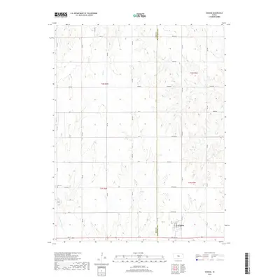
2018 Map of Windom
USGS Topo · Published 2018About this map
Windom anchors the southeastern corner of this Kansas landscape, situated near the intersection of Main St and Limestone Rd. This late-2010s survey illustrates a region defined by a precise section-line road network and numerous waterways that drain southward toward the Little Arkansas River. The boundary between Rice and McPherson Counties bisects the terrain, creating a transition between local jurisdictions. Genealogists and local historians will find the Bean Cem in the western reaches of the map, located along Co Rd 202. The drainage patterns of Wolf Cr, Sharps Cr, Salt Cr, and Lone Tree Cr provide a clear view of the natural topography that underlies the agricultural grid, revealing the subtle contours of the plains.
Find a feature on this map
40 named features on this map. Tap any name to fly to it.
Don’t see what you’re looking for? This feature index may not catch every label — zoom into the map to look around manually.
Map Details
Editions of this 2018 Windom Map
This is the sole edition of this map. No revisions or reprints were ever made.
Other maps of this area

1891 · Hutchinson
USGS Topo · 1:125,000

1892 · Salina
USGS Topo · 1:125,000

1893 · Hutchinson
USGS Topo · 1:125,000

1894 · Ellsworth
USGS Topo · 1:125,000

1894 · Lyons
USGS Topo · 1:125,000

1942 · Salina
USGS Topo · 1:125,000

1955 · Great Bend
USGS Topo · 1:250,000

1955 · Hutchinson
USGS Topo · 1:250,000

1957 · Great Bend
USGS Topo · 1:250,000

1958 · Great Bend
USGS Topo · 1:250,000