
1928 Map of Windsor
USGS Topo · Published 1928About this map
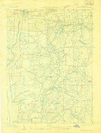
The Connecticut River and Farmington River define the development of this northern Hartford County landscape in the late 1920s. Established settlements like Windsor and Bloomfield are shown alongside emerging residential pockets such as Cottage Grove and Wilson. The dense grid of Hartford dominates the lower portion of the sheet, illustrating the transition from urban centers to the agricultural and suburban outskirts of West Hartford and Bloomfield.
Find a feature on this map
23 named features on this map. Tap any name to fly to it.
Don’t see what you’re looking for? This feature index may not catch every label — zoom into the map to look around manually.
Map Details
Editions of this 1928 Windsor Map
This is the sole edition of this map. No revisions or reprints were ever made.
Other maps of this area

1892 · Hartford
USGS Topo · 1:62,500

1892 · Meriden
USGS Topo · 1:62,500

1892 · Granby
USGS Topo · 1:62,500

1893 · Middletown
USGS Topo · 1:62,500

1893 · Meriden
USGS Topo · 1:62,500

1906 · Farmington
USGS Topo · 1:125,000

1928 · Windsor Locks
USGS Topo · 1:24,000

1928 · Glastonbury
USGS Topo · 1:24,000
1928 · Broad Brook
USGS Topo · 1:24,000

1928 · Manchester
USGS Topo · 1:24,000