Loading...
Loading map...2022 Map of Windsor
USGS Topo · Published 2022About this map
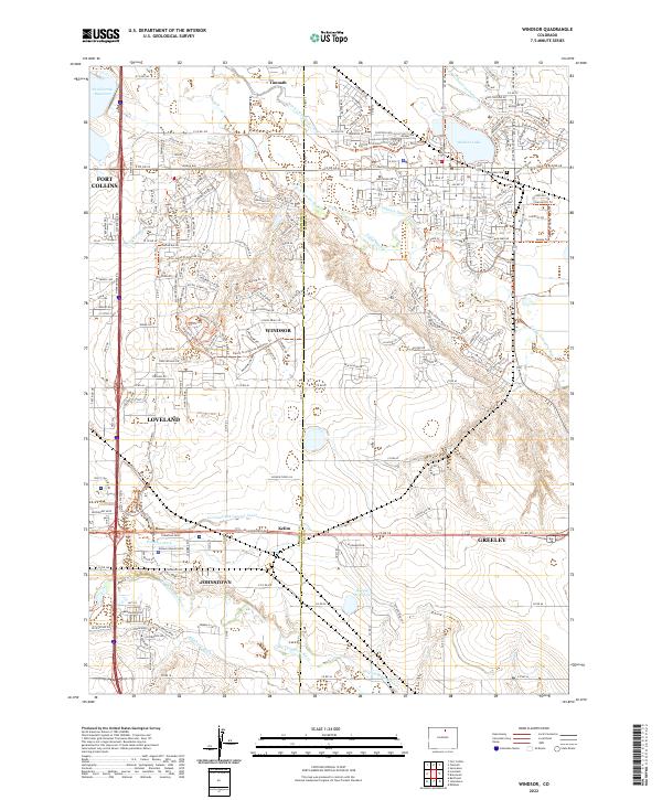
The Cache la Poudre River winds through this landscape, defining the agricultural and hydraulic development of Weld and Larimer Counties. This region is marked by an extensive network of irrigation infrastructure, including the Greeley Number 2 Canal, Farmers Ditch, and Hillsboro Ditch, which support the surrounding farmland. The town of Windsor serves as a central hub, situated near Windsor Lake and the Lakeview Cem.
Find a feature on this map
200 named features on this map. Tap any name to fly to it.
Don’t see what you’re looking for? This feature index may not catch every label — zoom into the map to look around manually.
Map Details
Date Portrayed2022
Date Published2022
PublisherU.S. Geological Survey
Map TypeTopographic
Scale1:24000
Physical Dimensions24 x 29 inches
Editions of this 2022 Windsor Map
This is the sole edition of this map. No revisions or reprints were ever made.
Historical Maps of Fort Collins Through Time
Featured Locations
Source Details
SourceU.S. Geological Survey
CopyrightPublic Domain