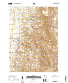
2020 Map of Windy Point
USGS Topo · Published 2020About this map
The Trout Creek Mountains dominate this high-desert landscape in southeastern Harney County, characterized by a complex network of seasonal drainages and isolated water sources. Human modification of the arid terrain is evident through features like the Holloway Ditch and multiple catchment systems including Oriana Reservoir and Red Mountain Reservoir. These developments highlight the historic necessity of water management for livestock and land use in this remote corner of Oregon.
Find a feature on this map
31 named features on this map. Tap any name to fly to it.
Don’t see what you’re looking for? This feature index may not catch every label — zoom into the map to look around manually.
Map Details
Editions of this 2020 Windy Point Map
This is the sole edition of this map. No revisions or reprints were ever made.
Other maps of this area

1886 · Disaster
USGS Topo · 1:250,000

1893 · Disaster
USGS Topo · 1:250,000

1954 · Vya
USGS Topo · 1:250,000

1955 · Adel
USGS Topo · 1:250,000

1957 · Adel
USGS Topo · 1:250,000

1958 · Vya
USGS Topo · 1:250,000

1958 · Adel
USGS Topo · 1:250,000

1961 · Trident Peak
USGS Topo · 1:62,500

1962 · Vya
USGS Topo · 1:250,000

1962 · Adel
USGS Topo · 1:250,000