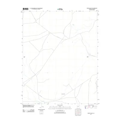
2011 Map of Windy Valley
USGS Topo · Published 2011About this map
Windy Valley and the surrounding high desert terrain are defined by a sparse network of tribal routes and remote water sources in this northern Arizona landscape. The presence of Toh Dah Hee Dat Conii and Little Pipe Spring indicates the critical importance of localized water points for land use and ranching in this arid environment. Significant topographic landmarks, such as Window Rock and the White Hills, provide orientation in a region where travel is primarily facilitated by Indian Rte 18 and Indian Rte 59. The inclusion of the Old Denehotso Rd suggests a landscape of long-established transit corridors connecting isolated points across the Navajo Nation. This 2011 survey serves as a modern record of geographical features and infrastructure prior to more recent development, documenting the enduring spatial relationship between natural landmarks and indigenous travel ways.
Find a feature on this map
9 named features on this map. Tap any name to fly to it.
Don’t see what you’re looking for? This feature index may not catch every label — zoom into the map to look around manually.
Map Details
Editions of this 2011 Windy Valley Map
This is the sole edition of this map. No revisions or reprints were ever made.
Other maps of this area

1892 · Canyon De Chelly
USGS Topo · 1:250,000

1954 · Shiprock
USGS Topo · 1:250,000

1958 · Shiprock
USGS Topo · 1:250,000

1959 · Shiprock
USGS Topo · 1:250,000

1968 · Rock Point SW
USGS Topo · 1:24,000
1968 · White Point
USGS Topo · 1:24,000
1968 · Many Farms NE
USGS Topo · 1:24,000

1968 · Many Farms SW
USGS Topo · 1:24,000

1968 · Windy Valley
USGS Topo · 1:24,000
1968 · Many Farms
USGS Topo · 1:24,000