2022 Map of Winfield
USGS Topo · Published 2022About this map
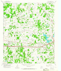
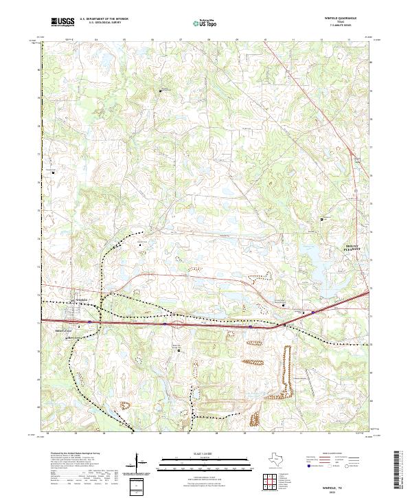
Winfield and Miller's Cove anchor this portrait of northeast Texas, where the landscape is defined by a dense network of creek drainages and small-scale infrastructure. The area is characterized by numerous family and community burial grounds, including Marshall Springs Cem, Tranquil Cem, and Damascus Cem, reflecting a long-established rural settlement pattern. The terrain is divided by several significant waterways such as Ripley Cr, McCullough Cr, and Tankersley Creek, which feed into local reservoirs like Tankersley Lake and Davis Newsom Lake. Transportation corridors like FM 899 and Farm Rd 1734 connect these dispersed points of interest, while Glover Airport serves as a small aviation hub for the county. The presence of Farmers Academy Cem suggests the location of a former educational site that once served the local agricultural community.
Find a feature on this map
74 named features on this map. Tap any name to fly to it.
Don’t see what you’re looking for? This feature index may not catch every label — zoom into the map to look around manually.
Map Details
Editions of this 2022 Winfield Map
This is the sole edition of this map. No revisions or reprints were ever made.