
1965 Map of Winfield
USGS Topo · Published 1967About this map
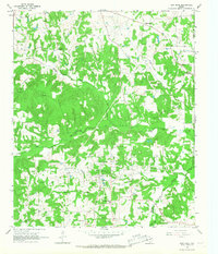
Winfield serves as the primary hub of this East Texas landscape in the mid-1960s, situated along the St Louis Southwestern railroad. The map reveals a community defined by its rural institutions and water sources, with numerous churches and cemeteries anchoring the local social geography. Notable landmarks like the Marshall Springs Ch and Damascus Ch stand alongside smaller settlements such as Farmers Academy and West Midway. The eastern portion of the quadrangle is dominated by Tankersley Lake and its associated infrastructure, including a Pumping Sta. The terrain is drained by several named waterways, including McCullough Creek and Dragoo Creek, which cut through a mix of wooded and cleared land. This period of the county's development is marked by the presence of modern utilities like the Substation near Winfield and the Radio Tower (KIMP) to the east.
Find a feature on this map
30 named features on this map. Tap any name to fly to it.
Don’t see what you’re looking for? This feature index may not catch every label — zoom into the map to look around manually.
Map Details
Editions of this 1965 Winfield Map
This is the sole edition of this map. No revisions or reprints were ever made.
Other maps of this area

1953 · Texarkana
USGS Topo · 1:250,000

1956 · Texarkana
USGS Topo · 1:250,000

1964 · Mount Vernon
USGS Topo · 1:24,000

1964 · Harvard
USGS Topo · 1:24,000

1964 · Wilkinson
USGS Topo · 1:24,000

1964 · Talco
USGS Topo · 1:24,000

1964 · Hagansport
USGS Topo · 1:24,000

1965 · Monticello
USGS Topo · 1:24,000
1965 · New Hope
USGS Topo · 1:24,000

1965 · Mount Pleasant
USGS Topo · 1:24,000