
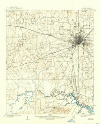
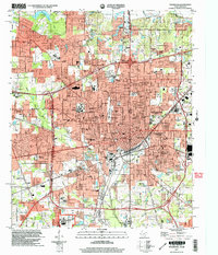
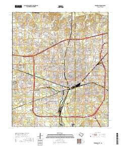
1956 Map of Texarkana
USGS Topo · Published 1956About this map
The Red River corridor defines this mid-century landscape where Texas, Oklahoma, and Arkansas meet. This survey shows the region's heavy military and industrial footprint following the war years, most notably the Camp Maxey Military Reservation (Abandoned) north of Paris, alongside active installations like the Red River Ordnance Depot and Lone Star Ordnance Plant west of Texarkana. The drainage of the Sulphur River into the newly formed Lake Texarkana illustrates the hydraulic engineering of the era, while the vast network of the Texas and Pacific RR and St Louis Southwestern RR still supports the commercial centers of Mount Pleasant, Clarksville, and Sulphur Springs. These rail lines connect the numerous agricultural towns and county seats that anchor the Blackland Prairies and Piney Woods regions during a period of significant post-war transition.
Find a feature on this map
68 named features on this map. Tap any name to fly to it.
Don’t see what you’re looking for? This feature index may not catch every label — zoom into the map to look around manually.
Map Details
Editions of this 1956 Texarkana Map
This is the sole edition of this map. No revisions or reprints were ever made.
Historical Maps of Texarkana Through Time
13 maps found
1909 Texarkana
Bowie County, TX
1953 Texarkana
Bowie County, TX
1954 Texarkana
Bowie County, TX
1954 Texarkana
Bowie County, TX
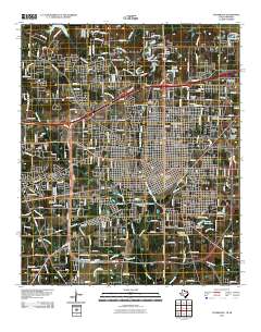
1956 Texarkana
Bowie County, TX

1986 Texarkana
Bowie County, TX

1992 Texarkana
Bowie County, TX
2001 Texarkana
Bowie County, TX
2011 Texarkana
Bowie County, TX
2013 Texarkana
Bowie County, TX
2016 Texarkana
Bowie County, TX
2019 Texarkana
Bowie County, TX
2022 Texarkana
Bowie County, TX