
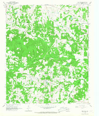
1965 Map of Monticello
USGS Topo · Published 1967About this map
Big Cypress Creek meanders across this landscape, defining the boundary between Titus and Camp counties during the mid-1960s. The settlement of Monticello sits north of the creek, while Rocky Mound and Blodgett serve as further anchors for the rural community. The area is characterized by a dense network of country churches, including Adams Chapel, Blundell Creek Ch, and Green Pasture Ch, reflecting the deep-seated social geography of Northeast Texas.
Find a feature on this map
22 named features on this map. Tap any name to fly to it.
Don’t see what you’re looking for? This feature index may not catch every label — zoom into the map to look around manually.
Map Details
Editions of this 1965 Monticello Map
This is the sole edition of this map. No revisions or reprints were ever made.
Other maps of this area

1953 · Texarkana
USGS Topo · 1:250,000

1956 · Texarkana
USGS Topo · 1:250,000

1956 · Tyler
USGS Topo · 1:250,000

1960 · Newsome
USGS Topo · 1:24,000

1960 · Leesburg
USGS Topo · 1:24,000

1960 · Pittsburg
USGS Topo · 1:24,000

1964 · Mount Vernon
USGS Topo · 1:24,000

1964 · Harvard
USGS Topo · 1:24,000

1965 · Winfield
USGS Topo · 1:24,000
1965 · New Hope
USGS Topo · 1:24,000